Hornet Drone Services provides fast, accurate aerial data to help construction crews, surveyors, and industrial teams make smarter decisions and reduce rework. Our advanced drone mapping, thermal imaging, and LiDAR scanning improve efficiency, safety, and bottom-line results. We specialize in delivering high-resolution visuals and geospatial data that integrate seamlessly into your existing workflows. Whether you’re tracking earthwork progress, measuring stockpiles, or inspecting solar panels, we provide the insights you need—when you need them.
Hornet Drone Services provides aerial imaging and data solutions across Central Oregon—including Redmond, Bend, Prineville, and Madras—specializing in roof inspections, construction surveys and progress imagery, solar farm thermal scans, professional real estate photography, and land prospecting for developers.
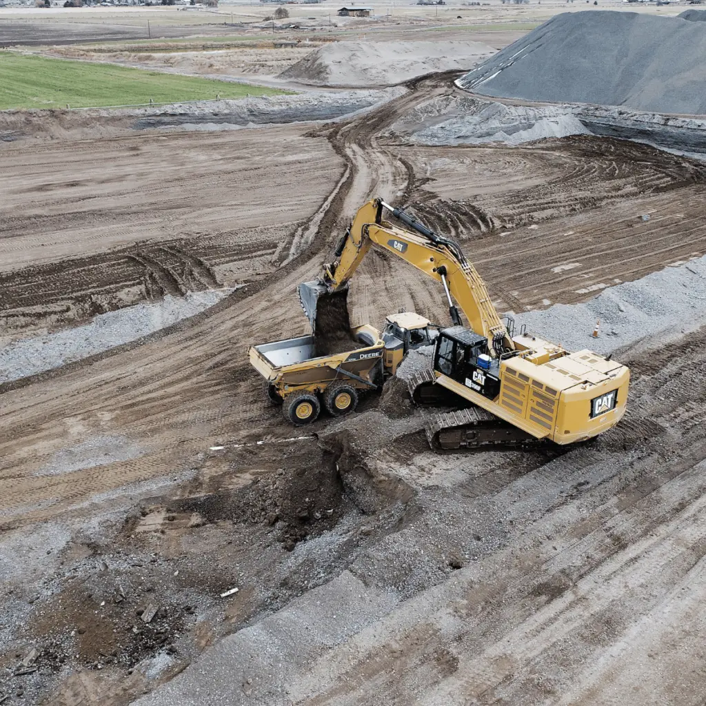
Construction
Our construction drone services deliver high-resolution mapping, progress tracking, and volumetric data to help Central Oregon contractors streamline earthwork, improve accuracy, and stay on schedule.
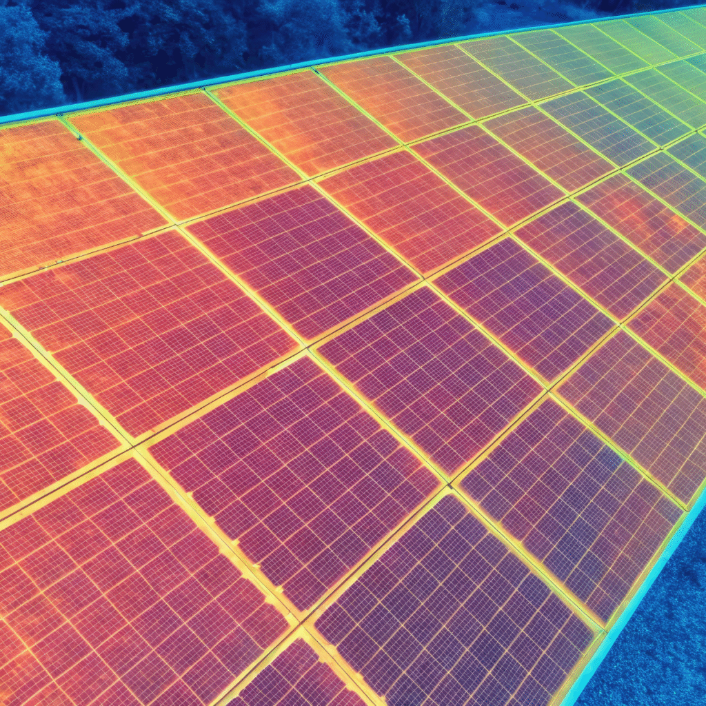
Solar & Wind Farms
We provide thermal and visual drone inspections for solar and wind farms across Central Oregon, helping operators quickly identify faulty panels, turbines, and maintenance issues with minimal downtime.
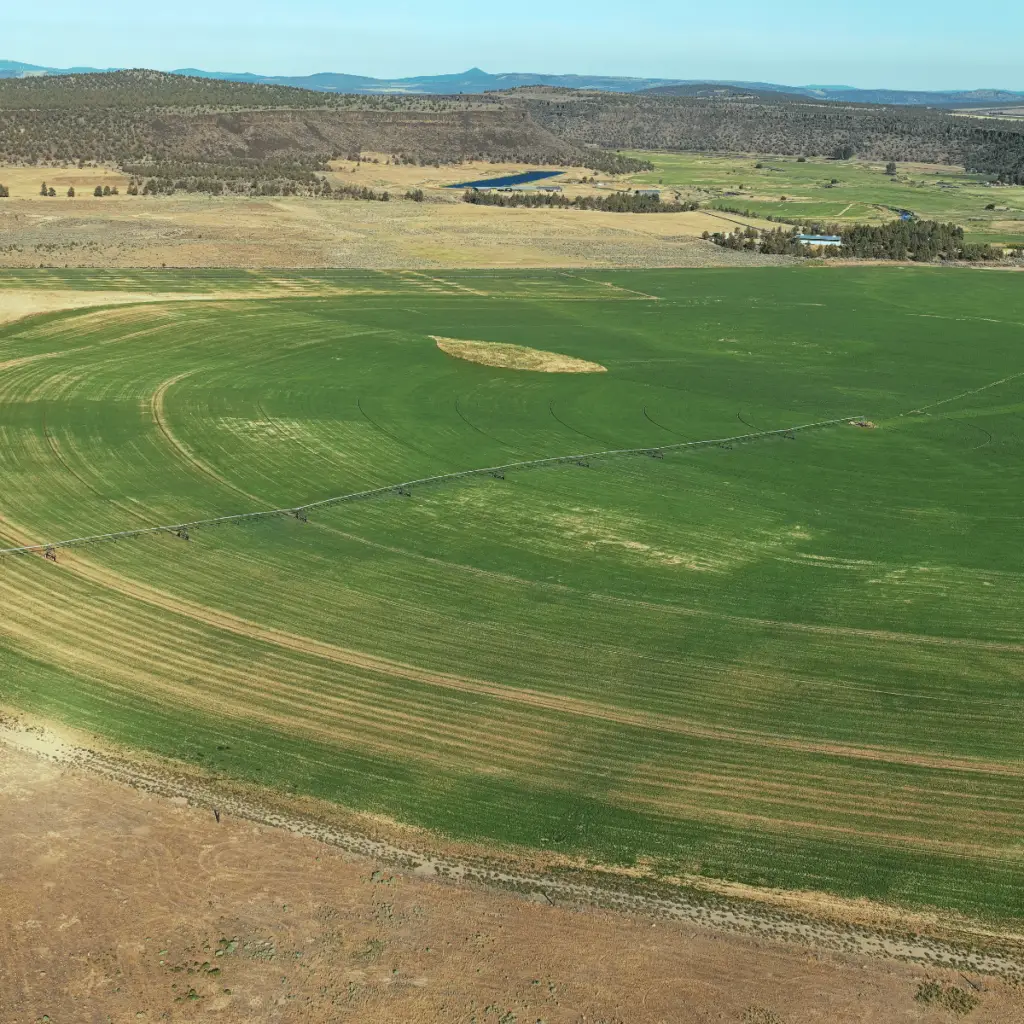
Agriculture
Our agricultural drone services offer crop health monitoring, irrigation analysis, and field mapping to help Central Oregon farmers make data-driven decisions and maximize yield.
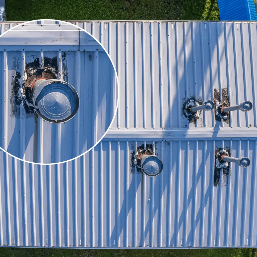
Roof Inspections
Hornet Drone Services provides fast, safe, and detailed roof inspections using high-resolution aerial imagery—ideal for residential, commercial, and insurance assessments across Central Oregon.
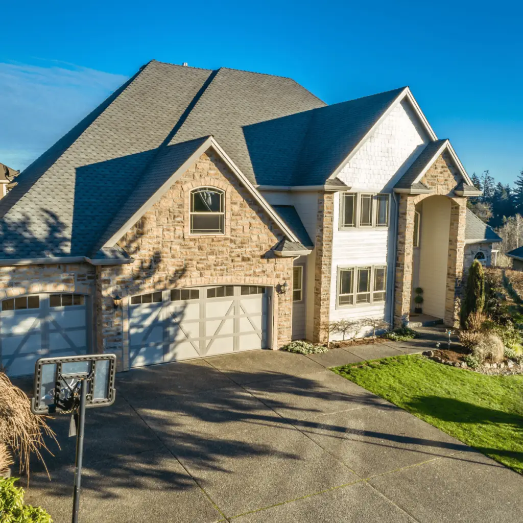
Real Estate
We offer professional drone photography and video services for real estate listings, showcasing properties in Bend, Redmond, Prineville, and beyond with stunning aerial visuals that capture attention.
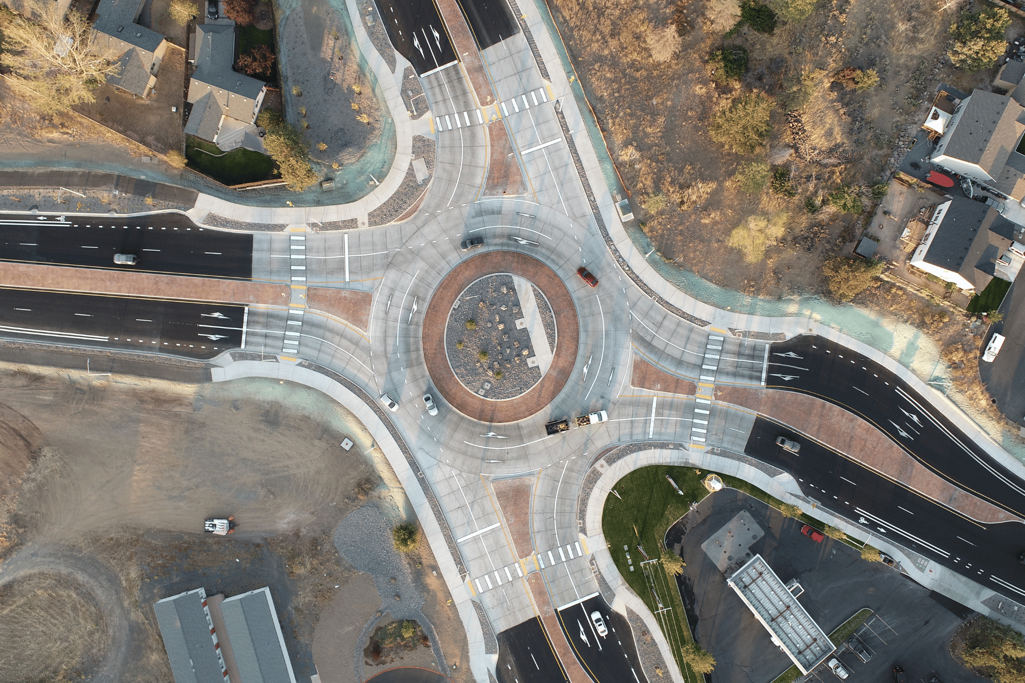
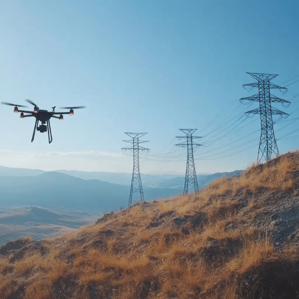
Municipalities
Hornet Drone Services supports municipalities across Central Oregon with aerial utility inspections, infrastructure assessments, and mapping solutions to improve safety, efficiency, and planning.
Led by Nick Crawley—an FAA Part 107 certified drone pilot, experienced helicopter pilot, and U.S. Army veteran with over two decades of aerial experience—Hornet Drone Services brings unmatched skill and precision to every flight.
Your Local Drone Experts Serving Deschutes, Jefferson, and Crook Counties
Hiring Hornet Drone Services means faster turnarounds, greater accuracy, and safer job sites—delivering the high-quality aerial data you need to make confident, cost-effective decisions.
Precision Data, Fast
We deliver high-resolution maps, models, and imagery quickly—helping you stay ahead of deadlines and avoid costly rework.
Enhanced Safety
Our drone inspections reduce the need for crews to access hazardous areas, minimizing risk and improving on-site safety.
Local Expertise
Based in Central Oregon, we understand the terrain, permitting, and seasonal challenges unique to Deschutes, Jefferson, and Crook Counties.
Proven Aerial Experience
With over 20 years of flight experience, including manned aircraft and military service, our pilot brings unmatched skill and reliability to every mission.
Hornet Drone Services is fully licensed and insured, giving you peace of mind that every flight meets FAA regulations and industry safety standards.