- Home
- LIDAR
LIDAR
LiDAR Drone Scanning Services in Central Oregon
Serving Bend, Redmond, Prineville, Sisters, Madras, La Pine & Terrebonne
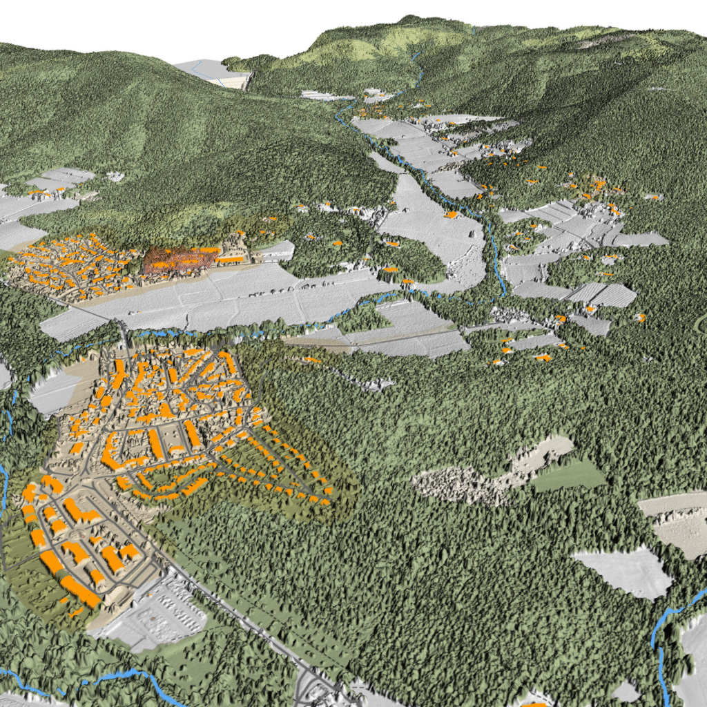
Hornet Drone Services provides precision LiDAR scanning and mapping across Central Oregon — helping professionals in construction, surveying, forestry, engineering, mining, and environmental sciences capture the most accurate terrain and structural data available today.
Whether you need to map dense forest canopy, measure stockpiles, assess construction sites, or detect sinkholes, our aerial and terrestrial LiDAR systems deliver survey-grade accuracy with exceptional detail and efficiency.
Why Choose Hornet Drone Services for LiDAR Scanning
Local Expertise – Based in Central Oregon, we understand the region’s varied terrain, vegetation, and environmental challenges.
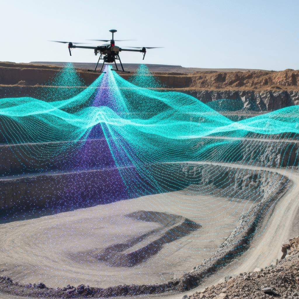
Dual LiDAR Systems – We combine aerial LiDAR for wide-area mapping with terrestrial SLAM LiDAR for detailed ground-level scans, producing the most complete and accurate datasets possible.
Survey-Grade Accuracy – Our workflows are built for engineers, surveyors, and GIS professionals who require precision down to the centimeter.
Fast Turnaround – Drone-based LiDAR reduces project timelines from weeks to days, without sacrificing accuracy.
Seamless Data Integration – LiDAR deliverables are fully compatible with leading CAD, GIS, and modeling platforms.
Applications of Drone LiDAR Scanning
Construction, Surveying & Engineering
Civil engineers and surveyors rely on LiDAR for exact measurements during design, planning, and construction phases.
Our data supports:
Accurate topographic mapping and design surfaces
As-built model creation when drawings are incomplete
Site feasibility and grading analysis
Vegetation and slope gradient measurements
Tying models to survey-grade control points
Forestry & Geosciences
LiDAR delivers unmatched precision for forest monitoring and earth science research, even through dense canopy cover.
Applications include:
Forest inventory (height, density, and biomass)
Wildlife habitat and vegetation analysis
Wildfire management planning
Tree segmentation and classification using AI
Landslide and watershed assessment
Power Line & Utility Inspection
Maintain safety and reliability across high-voltage power networks with precision LiDAR mapping.
Our inspections help utilities:
Measure vegetation encroachment near lines
Detect sagging or damaged wires
Predict and flag future risk areas
Conduct post-storm or seasonal monitoring
Integrate vegetation management data directly into GIS systems
Mining, Agriculture & Environmental Monitoring
From volumetric stockpile analysis to erosion tracking and crop modeling, LiDAR supports accurate measurement and sustainable management practices.
Use cases include:
Mine site mapping & mineral exploration
Landform change detection
Irrigation planning and field analysis
Conservation and environmental impact studies
Sinkhole Detection & Monitoring
LiDAR’s ability to penetrate vegetation and measure the ground surface makes it an ideal tool for sinkhole detection.
Hornet Drone Services performs quarterly or annual scans to track sinkhole development and ground movement — offering actionable insights for land developers, geologists, and municipalities.
Architecture & Heritage Preservation
Preserve history with precision. LiDAR scanning creates highly detailed digital twins of architectural and heritage sites — perfect for restoration planning, documentation, and structural analysis.
Industries We Serve
Construction & Civil Engineering
Land Development & Surveying
Forestry & Geo Sciences
Oil & Gas
Mining & Mineral Exploration
Agriculture
Environmental Monitoring & Conservation
Architecture & Heritage Preservation